I’ve always used Google Maps for navigation in the car, but now that I’ve moved to Los Angeles, I am using it for a different purpose: bus maps.
Because I wasn’t much of a bus rider before, I never paid much attention to the Bus mode on Google Maps.
Now that I’m car-less in L.A., the Bus feature on Google Maps for iPhone is a crucial tool that I rely heavily on to get around.
By simply touching the Bus icon at the top of the map when you look up directions, you bring up the suggested transit route, with information on the bus number and scheduled arrival time.
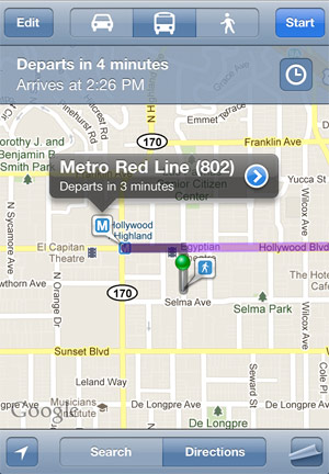
What’s more, touching the clock in the upper right hand corner will bring up a list of the upcoming bus arrivals, so that you may choose to plan a later trip.
![]()
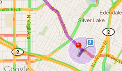
Once you arrive, Maps will give you walking directions (if applicable) to arrive at your destination.
Highly recommended for transit-riding iPhone owners.
Would be nice to have maps for the metro rail line, though…